Nowa Huta Layover: Kraków's Socialist City
Part of the full Kraków Layover: Old Town and Wawel From KRK
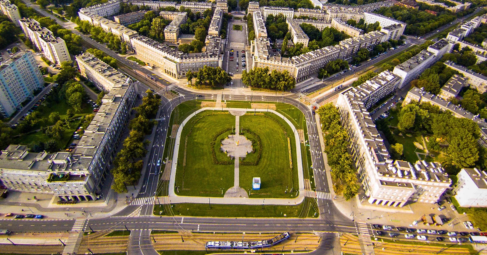
Nowa Huta was laid out east of Kraków from 1949 as a steelworkers’ city with five avenues running off one square, and the walk between its pebble-clad church, its steelworks gate and its Cold War shelters is at tram scale rather than Old Town scale.
Plac Centralny and the five avenues off it
Ground was broken in 1949 on farmland outside Kraków, with Tadeusz Ptaszycki as chief architect and a brief to build a city for a steelworks that did not exist yet. The plan he drew is half an octagon: one square at the focus and five avenues fanning out from it, with arcaded five-storey blocks turning the corners so the square reads as a single continuous facade rather than a crossroads.
Since 2004 the square has officially been named after Ronald Reagan, a change most people here ignore in favour of the plain description everyone already used. Standing in the middle of it, the thing to notice is the scale: the avenues are wide enough for a parade and long enough that the far end is a smudge, which is what the district was for.
The Lord’s Ark, a church faced in river pebbles
Nowa Huta was designed with no church in it. Residents put a wooden cross on the intended site in 1957; when the authorities came to take it away in April 1960 there were street battles with the militia, and permission was not granted for another five years. Karol Wojtyła, then archbishop here, pushed it through, laid a cornerstone from St Peter’s in 1969 and consecrated the finished building in May 1977.
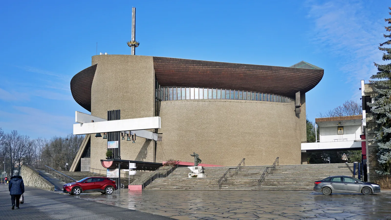
Wojciech Pietrzyk designed it as a ship: a hull of sloping concrete under a roof curved like a keel, with a 70-metre mast rising off the prow in the shape of a crowned cross. It went up over ten years, largely by volunteer labour and largely without state materials, and the walls are faced with river pebbles that parishioners gathered and set by hand. It is free to walk into and it is about two kilometres north of Plac Centralny.
The Renaissance-styled blocks at the steelworks gate
Solidarity Avenue runs two kilometres east from Plac Centralny and ends at a pair of matched stone buildings that are also the works’ main gate. They were finished in 1955 as the steelworks’ administrative centre, and the design is deliberate: an ornamental parapet along the roofline copied from the Cloth Hall in Kraków’s Old Town, so that a plant named after Lenin was fronted by a quotation from a 16th-century Polish trading house.
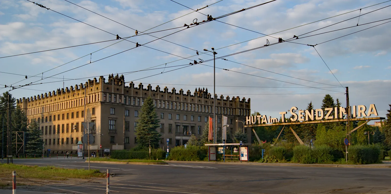
The plant behind them opened in 1954, was named after Lenin until 1990 and carries the metallurgist Tadeusz Sendzimir’s name now. It is a working site and not something you walk into, but the gate buildings, the avenue up to them and the scale of the whole approach are the point, and all of that is public ground.
The Światowid cinema and the shelter under it
The cinema on os. Centrum E went up in the 1950s with a row of square columns across its front, the standard socialist-realist gesture, and it stopped showing films long ago. The Museum of Kraków has its Nowa Huta branch in the building, and the building has been through repeated works, so it is worth checking it is open rather than assuming.
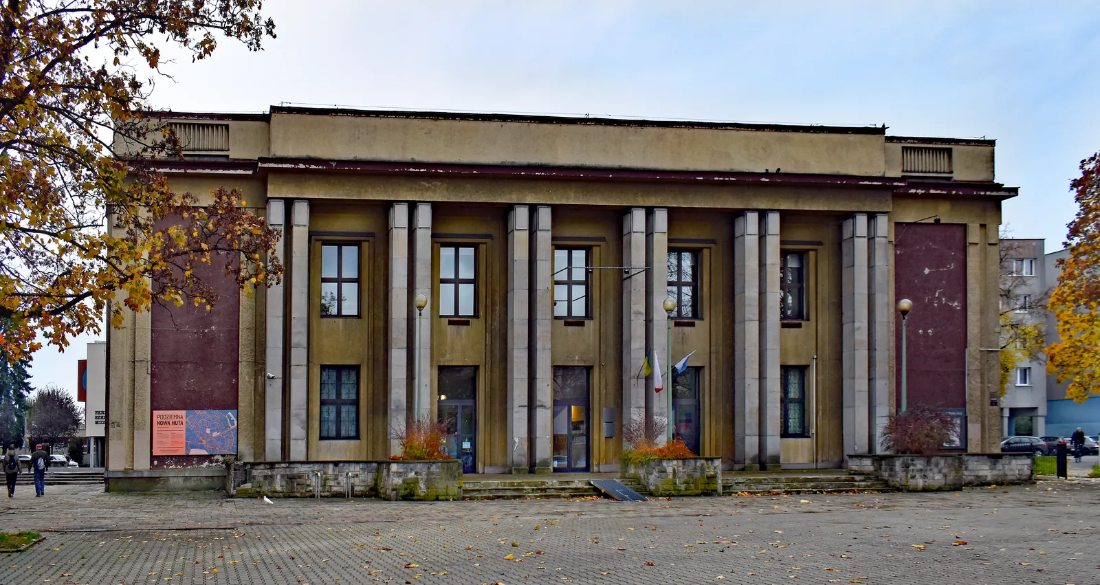
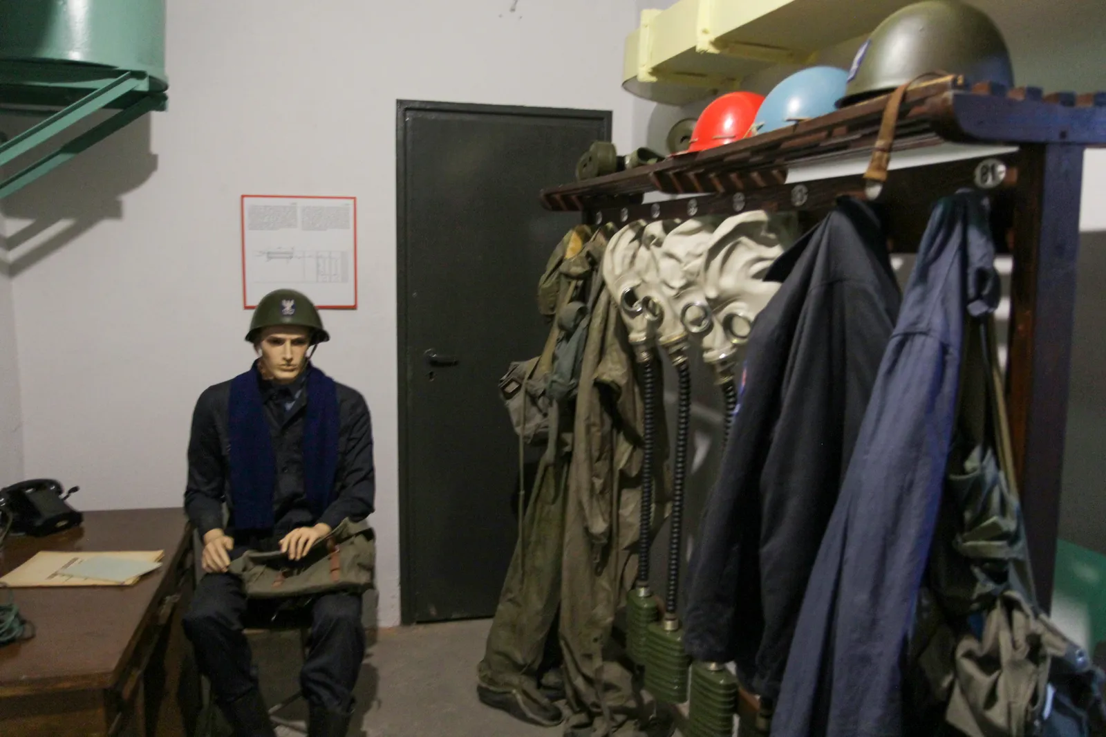
Underneath it, and under more than 250 other buildings across the district, is a shelter. They were dug in the 1950s against air raids and nuclear attack, and the ones the museum shows are kitted out as they were left: blast doors, filtration plant, racks of civil defence coats and gas masks. The exhibitions on os. Szkolne run Wednesday to Sunday on daytime hours, in small timed groups.
Plac Centralny to the steelworks gate is two kilometres of straight open avenue and the church is about the same in the other direction, with no shelter from weather along either, which is a long way to push a suitcase for a district built to be crossed by tram.
Nowa Huta is a tram ride from the station with the airport line
Kraków Główny is about 25 minutes back west by tram, most of it along one avenue, and it is the only station on the airport line. From there the SKA1, a regional service run by Koleje Małopolskie, reaches Kraków John Paul II International Airport in around 20 minutes for a flat 20 złoty, roughly twice an hour through the day and hourly early and late, with a covered footbridge of 200 to 250 metres at the airport end. Door to door from Plac Centralny, allow an hour and a quarter.
Nothing runs on that line between about 1am and 4am, when bus 902 covers the airport leg for 6 złoty and about 45 minutes.
Almost nothing out here charges admission, almost nothing has a queue, and the district is 25 minutes from a city that has both. What it asks in exchange is distance: this is the one route near Kraków where the tram is not optional between stops.
Frequently asked questions
Why do Nowa Huta addresses have no street names?
Because the district was numbered rather than named. Buildings sit on an osiedle, an estate, and the address is the estate's name plus a block number: os. Centrum E 1, os. Szkolne 37. Streets exist for the avenues but not inside the estates, so a map application will often want the estate name rather than anything you would recognise as a street, which catches out most first-time visitors.
How long does it take to reach Nowa Huta from Kraków's Old Town?
About 25 to 30 minutes on a tram from the eastern edge of the park ring, running most of the way along one avenue. That is each way, on top of a district where the stops are two kilometres apart, so three hours is the working minimum for making the trip worthwhile. Under that, the main Kraków route keeps everything inside a kilometre of the Main Market Square instead.
Can you go inside the Cold War shelters under Nowa Huta?
Yes, at the Museum of Kraków's shelter exhibitions on os. Szkolne, which run on daytime hours from Wednesday to Sunday in small timed groups. More than 250 shelters were built under the district in the 1950s and a handful are open; the district museum in the old Światowid cinema has been in and out of building works, so check it is open before travelling out for that one specifically.
Where do you eat in Nowa Huta?
Two places on the square have been serving since 1956 and neither has been redecorated in any hurry: a milk bar right on Plac Centralny, and the district's oldest restaurant on os. Centrum C. Both are cheap, both do the standard Polish plates, and both are more of the point out here than any restaurant in the Old Town, because the rooms themselves are the exhibit.