Auckland Layover Near Karanga-a-Hape Station
Part of the full Auckland in One Day: Sky Tower and Domain
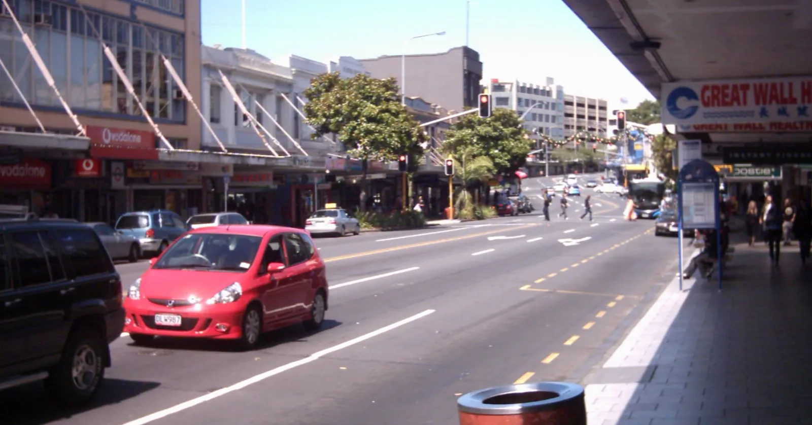
Karanga-a-Hape Station opened 33 metres beneath Karangahape Road in central Auckland on 13 September 2026, and what it surfaces into is a ridge: a 600-metre magenta cycleway laid over a dead motorway ramp, the 1842 cemetery holding New Zealand’s first governor, and a 1924 arcade that frames a park through its far windows.
Karangahape Road runs along a ridge with nothing sheltering it
Karangahape Road is the reason this station exists: a kilometre or so of two-storey Victorian and Edwardian shopfronts with verandahs over the footpath, running along the high ground that separates the city centre from the suburbs south of it. The platforms beneath it are 33 metres down, the deepest in New Zealand, served by the country’s longest escalator and by lifts at both entrances, one on Beresford Square and one on Mercury Lane.
Verandahs cover the shopfronts but almost nothing else up here does, and the walk between the ridge and the city centre has no continuous cover on it at all, which is worth knowing before committing a suitcase to the trip in Auckland weather.
Te Ara I Whiti is 600 metres of magenta on a dead motorway ramp
Where State Highways 1 and 16 cross south of the city centre, an off-ramp was built and then never used. In 2015 it was resurfaced in hot pink, railed in black, and lined with LED poles running a lighting system that reacts to people moving across it, and it opened on 3 December that year as Te Ara I Whiti, the path of light. Monk Mackenzie Architects and LandLAB designed it with the artist Katz Maihi.
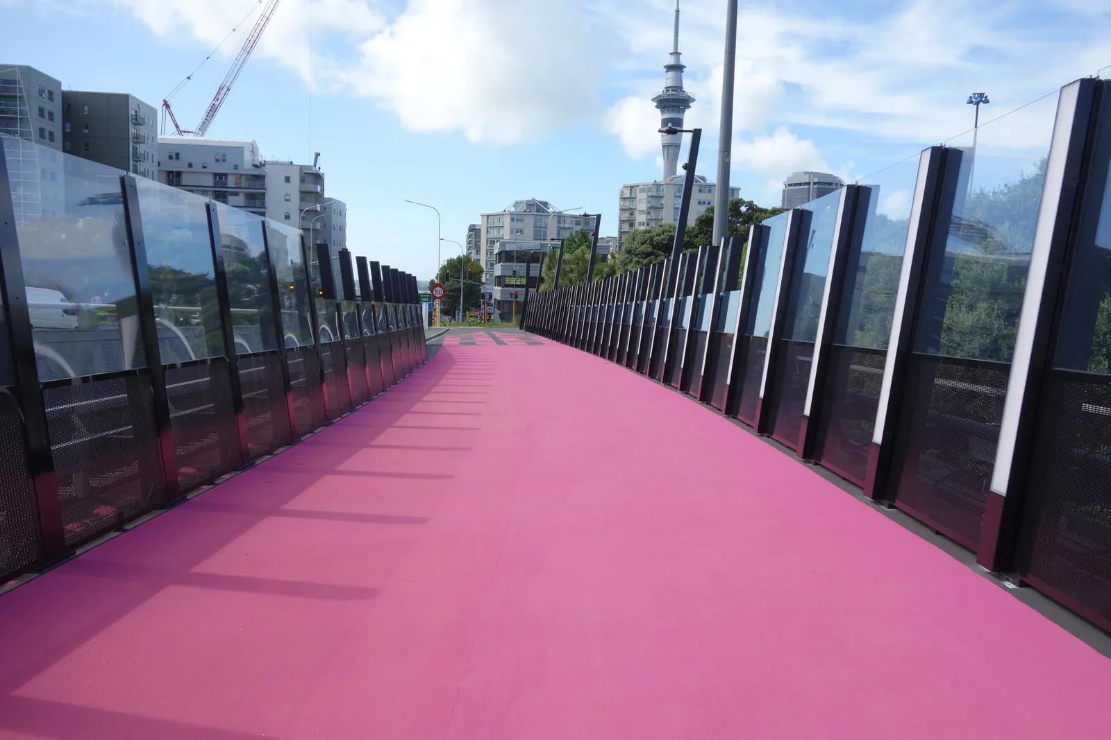
It is a shared path, so walking it is expected rather than tolerated, and it costs nothing at any hour. The colour holds up in flat daylight and the lighting does the work after dark. From the ramp it links north into Nelson Street and down towards the centre of town, and east to the Grafton Gully route, which makes it a usable way off the ridge rather than a detour that dead-ends.
St Kevin’s Arcade has framed the park below since 1924
At 183 Karangahape Road a shopping arcade opened in 1924 and was extended two years later, originally as tea rooms, and the thing it was designed around is still its best feature: the far end gives onto leadlight windows looking straight out over Myers Park and the towers behind it. The floor at the head of the stairs has the park’s name set into the tiles.
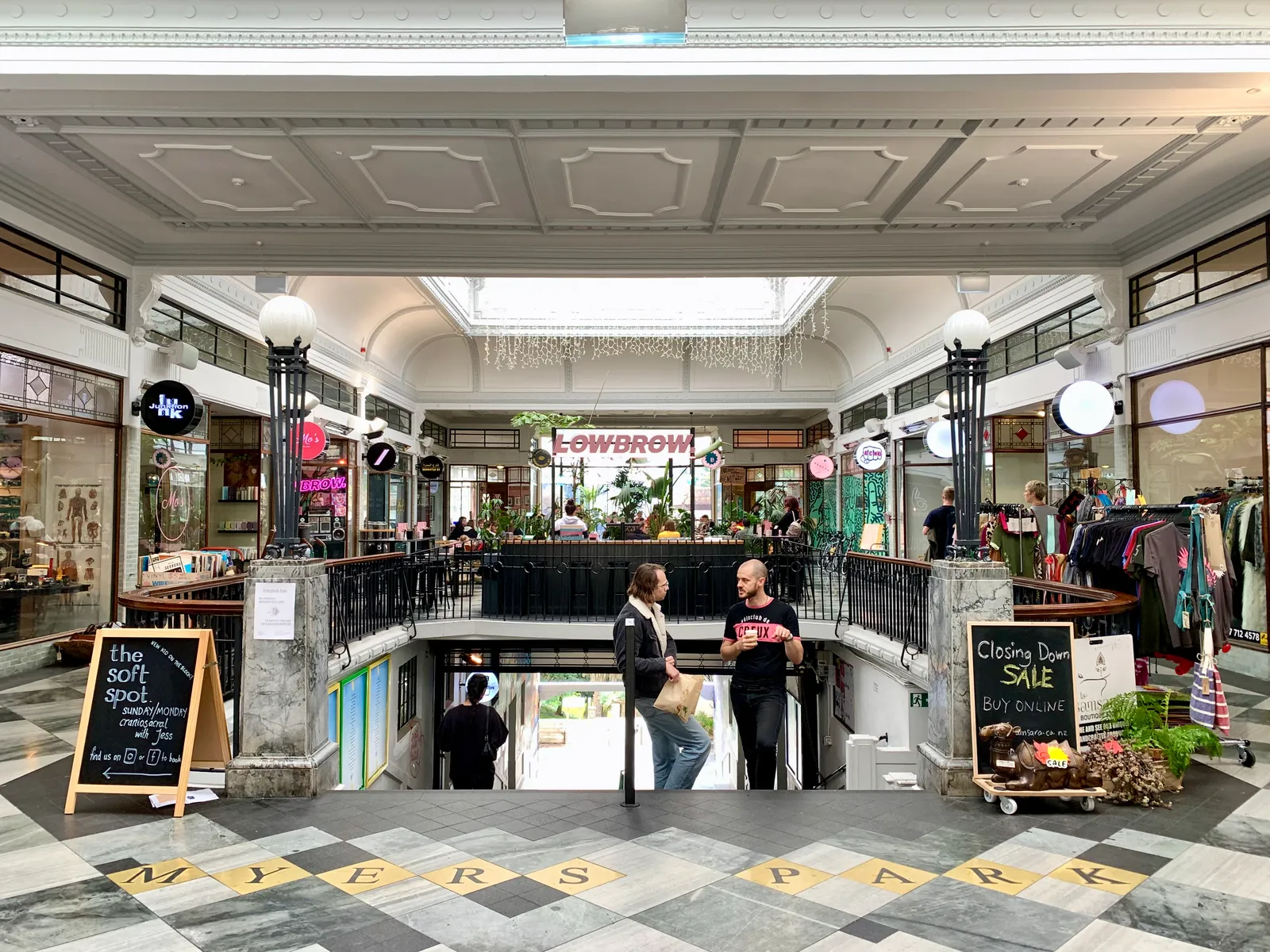
What fills it now is second-hand bookshops, vintage and independent fashion, studios and places to eat, and a restoration swapped out the 1970s interventions for granite, basalt and bronze. It is free to walk through and it is the one stop up here with a roof over it, which on this particular ridge matters more than it sounds. The main Auckland guide works the harbour end of town and the climb east to the Domain; from here the city is downhill, which is the opposite problem.
William Hobson is buried in Symonds Street Cemetery
Auckland’s first official burial ground has been in use since 1842, two years after the city was founded, and it holds a fair share of the people who founded it, William Hobson among them: the first governor of New Zealand and a co-author of the Treaty of Waitangi. It was laid out in four parts by denomination, Jewish, Catholic and Anglican grounds plus a shared plot for Wesleyans, Presbyterians and everyone else, and closed to new burials in 1886 once Waikumete opened out west.
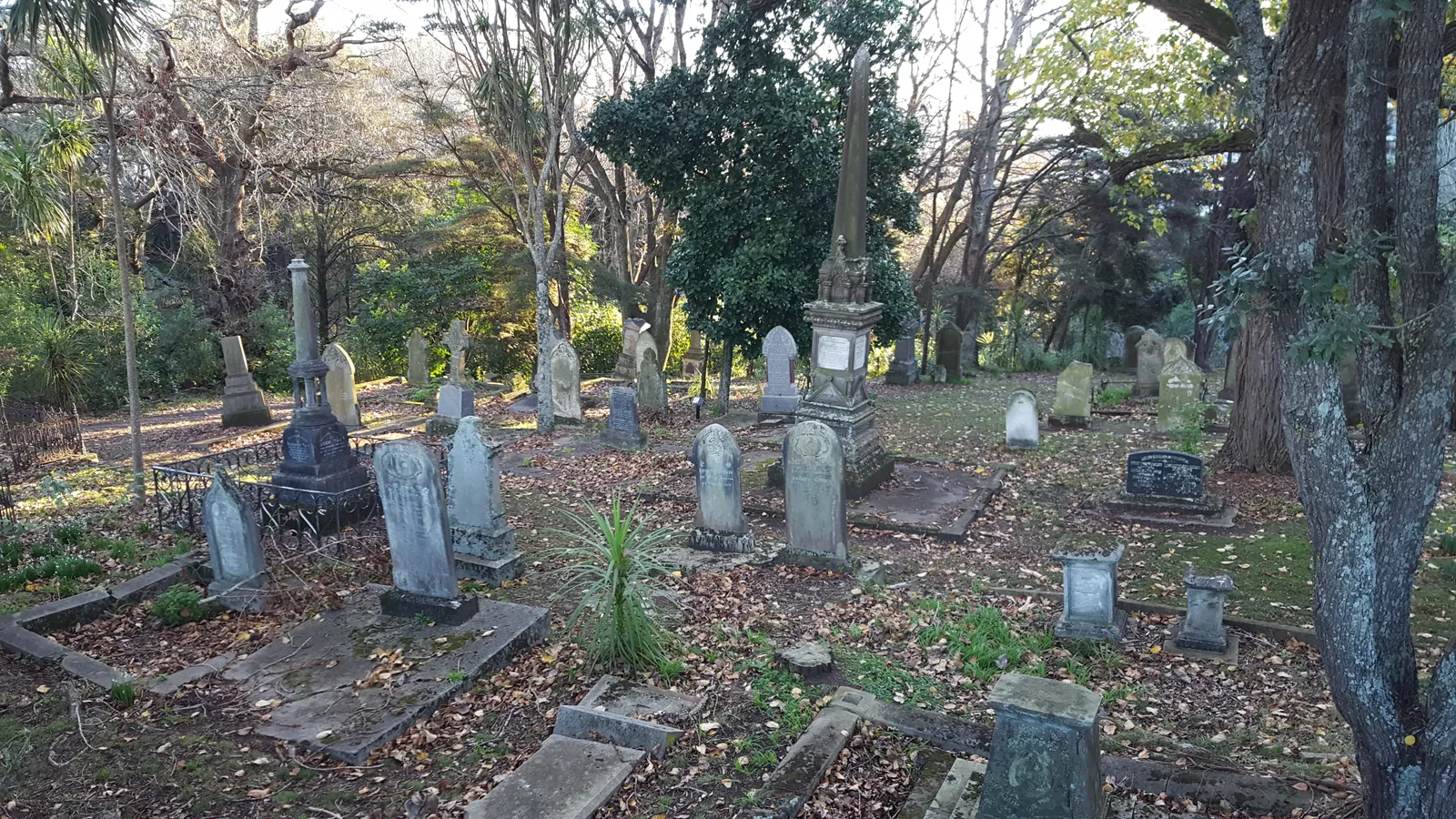
Grafton Bridge was driven straight over part of it in 1910, which is why headstones turn up hard against the bridge piers and why some of them are no longer where the people under them are. The paths through are open and free, and it is markedly quieter than anything else within walking distance.
One train and one bus back to Auckland Airport
Trains south from here reach Puhinui Station in a little over half an hour, and the orange AirportLink bus covers the rest, running every 10 minutes from 4.30am to 12.40am, 18 to 20 minutes to the international terminal and 13 to 17 to domestic. The pair count as a single three-zone fare, NZ$6.50 on a contactless card or an AT HOP card, and the real door-to-door number is close to an hour.
The direct coach does not come up onto the ridge. It runs between the city centre and both terminals half-hourly from 5am to 10.30pm for about NZ$20, 40 to 50 minutes when the motorway is behaving, so taking it means going down the hill first. Add the escalator at each end to whichever you pick, because 33 metres is a long way up with a bag in your hand.
Frequently asked questions
What should I do during a layover near Karanga-a-Hape Station in Auckland?
Three things sit within about ten minutes of the exits, and all of them are free. Te Ara I Whiti is 600 metres of hot-pink surfacing laid over a disused motorway off-ramp, lit by LEDs that respond to people crossing it. St Kevin's Arcade, built in 1924 at the top of Karangahape Road, still frames Myers Park through its leadlight windows. Symonds Street Cemetery, in use since 1842, holds William Hobson, New Zealand's first governor. Three or four hours is plenty; the ridge itself is the part worth slowing down for.
Which Karanga-a-Hape Station exit should I use?
There are two, and they come out on opposite sides of the ridge. The Mercury Lane exit puts you on the eastern half of Karangahape Road, closer to Symonds Street Cemetery and the walk down Grafton Bridge. The Beresford Square exit is the western one, better for St Kevin's Arcade and for picking up the route towards Te Ara I Whiti. Both have lifts alongside the escalators, and since the platforms sit 33 metres down, the country's deepest, it is worth choosing before you start moving rather than after.
Can you walk on Te Ara I Whiti, or is it only for cyclists?
Walking is fine. It is a shared path, and the lighting system was designed to respond to cyclists and pedestrians alike as they cross the old off-ramp. It connects north into Nelson Street and on towards the city centre, and east to the Grafton Gully route, so it works as a way down off the ridge as well as a thing to look at. There is no shelter on any of it.
What is the walk from Karangahape Road down to central Auckland like?
Downhill the whole way, which is the reverse of what most arrivals into Auckland deal with. Karangahape Road sits on a ridge, and Queen Street runs 1.7 kilometres from its southern end at the ridge down to the waterfront, so heading into town from here costs no climbing at all. Coming back up is the part to budget for. There is very little cover on the route, and Auckland rain tends to arrive without much warning.