Golden Gate Bridge on a San Francisco Layover
Part of the full San Francisco Layover: Cable Cars, SFO
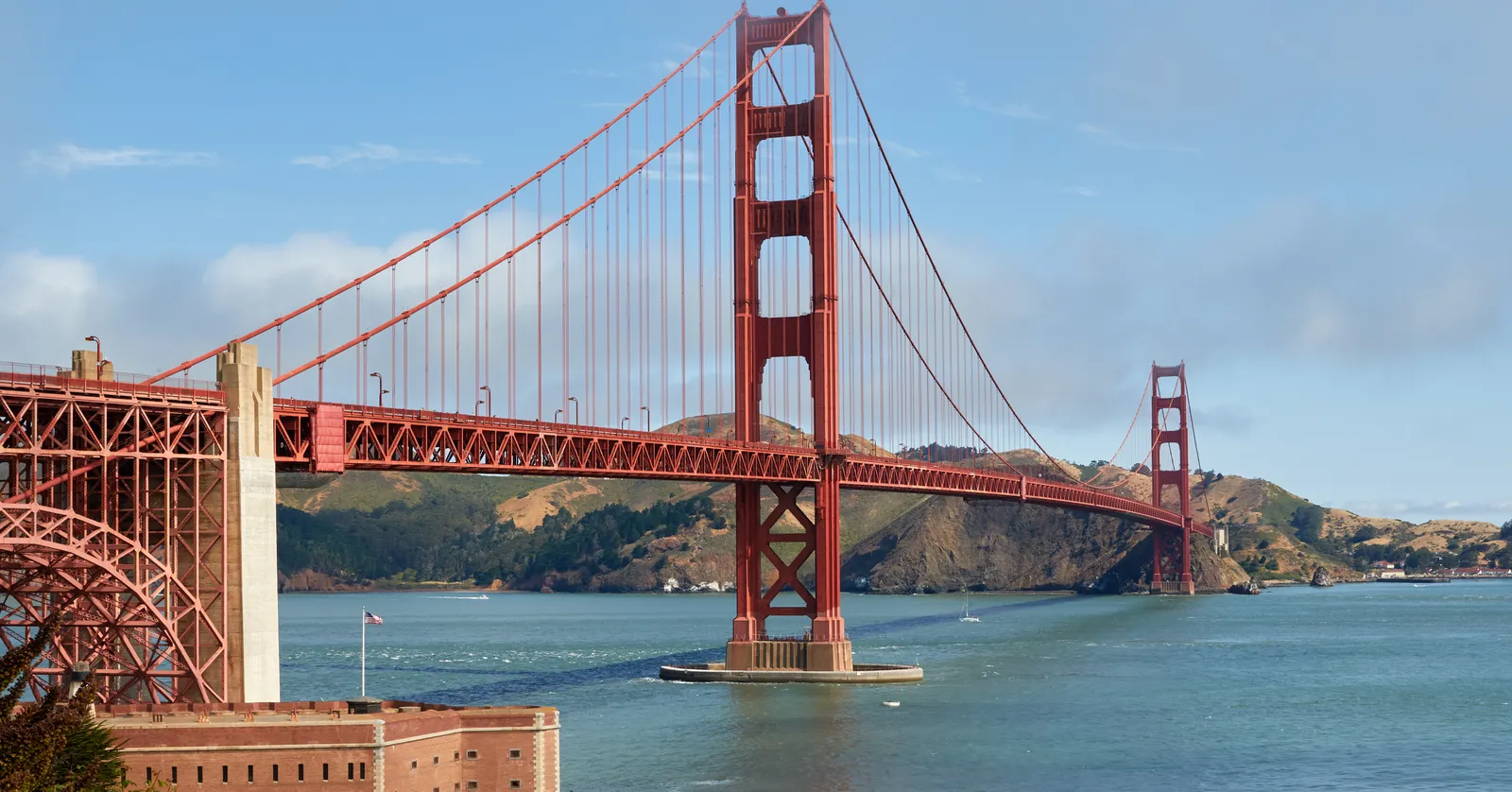
Walking San Francisco’s Golden Gate Bridge is free, on the east sidewalk only, and the 1861 brick fort the bridge was redesigned to spare sits underneath its southern end.
The east sidewalk is the only side pedestrians can use
The Golden Gate Bridge opened on 27 May 1937 with a 4,200-foot main span, the longest in the world until 1964, hung between towers 746 feet high. Irving Morrow, the consulting architect, argued the steel should stay the shade of orange primer it arrived in rather than be painted grey or black: it suits the headlands, and it holds up in fog. That is the colour the bridge has been ever since, and it has a name, international orange.
Pedestrians get the east sidewalk, the San Francisco-facing side, and nothing else. Hours follow the clocks: 5am to 6.30pm from early November to early March, 5am to 9pm the rest of the year, on automatic gates that do not wait for you. Cyclists use the west side and cross toll-free at any hour, which is why a guided ride with the bike included is the common way to do it on a tight schedule; there are no rentals at the bridge, so you pick one up back near the waterfront.
The crossing is 1.7 miles, so 35 to 40 minutes each way on foot, and the walkway is exposed from end to end. Wind comes straight through the strait and the fog does not keep office hours, so whatever you are carrying is out in it for the full length, in both directions, with nowhere at either end to put it down.
Fort Point kept its place by making the bridge bend around it
At the end of Marine Drive, directly under the bridge’s southern approach, is a three-storey fort of brick and granite finished in 1861 to guard the entrance to the bay. It never fired a shot in anger. It was slated for demolition when the bridge was designed, and Joseph Strauss redrew the south approach as a steel arch that steps over the fort rather than through it, which is why the roadway above it curves the way it does.
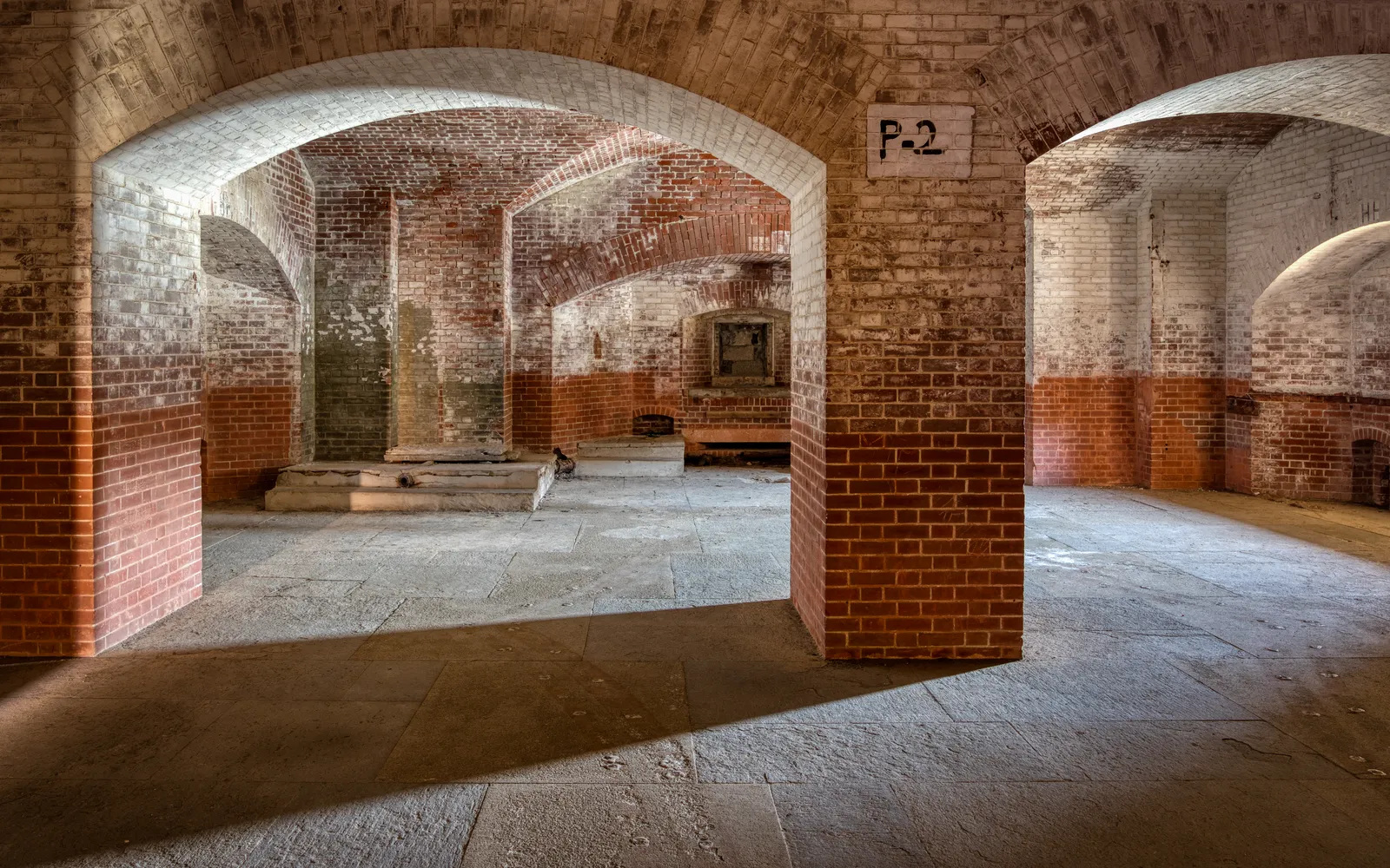
Inside are four tiers of arched casemates in bare brick, a spiral granite staircase, and a roof that puts you directly beneath the bridge deck with the water running past below. Entry is free. It opens Thursday to Monday, 10am to 5pm, with roof access closing at 4.30pm, and it shuts on Thanksgiving, Christmas and New Year’s Day; the exterior and the seawall in front of it can be walked any day of the week.
Crissy Field is the flat mile between the Marina and the bridge
Crissy Field was a military airfield until 1936 and a paved storage yard for decades after that. What the Presidio Trust and the Park Service put back in the late 1990s is a restored tidal marsh, a beach, and a wide gravel promenade running along the shoreline, with the bridge in front of you the entire way.
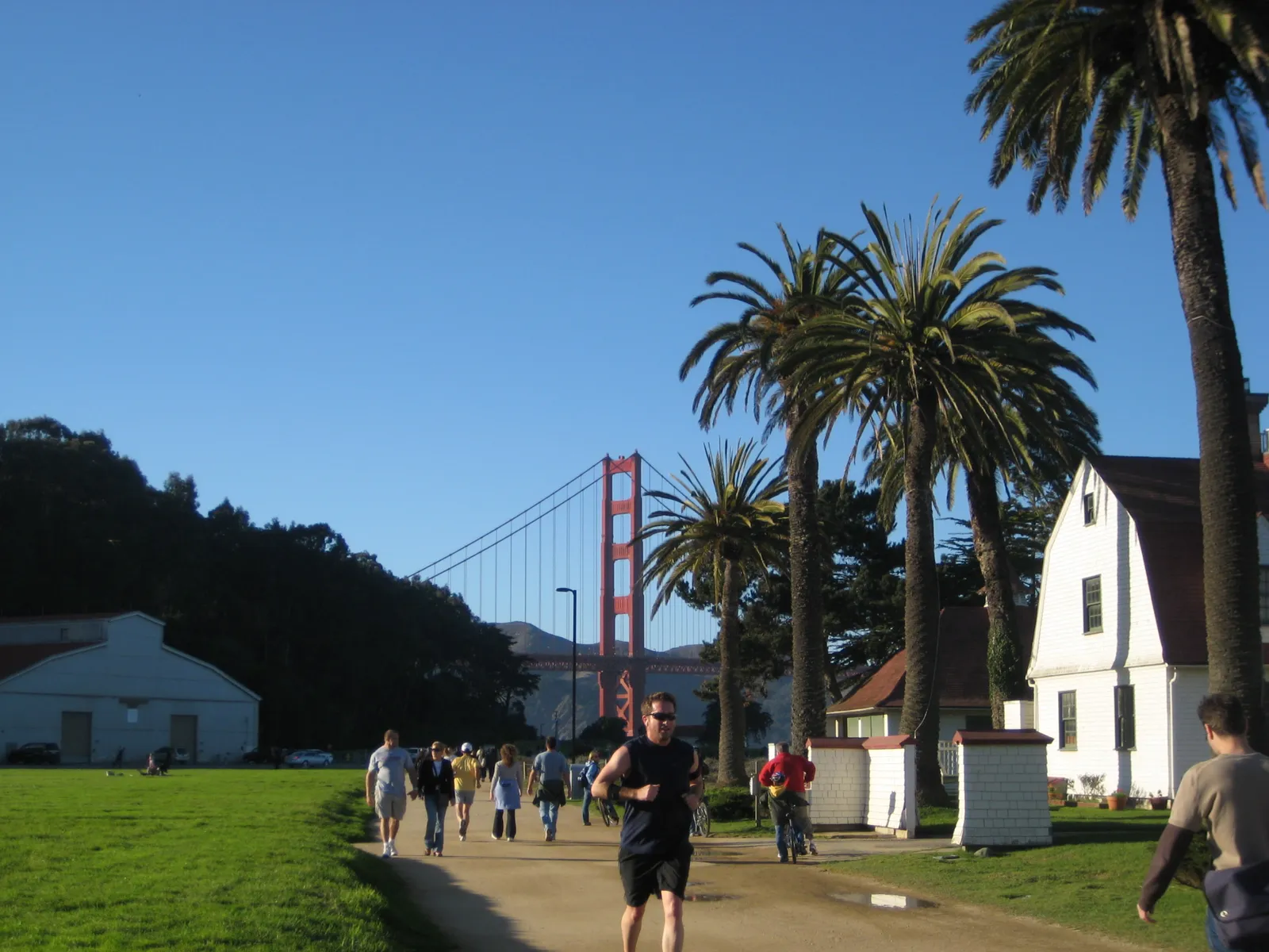
It is flat, it is free, and it takes about half an hour to walk from the Marina end to the fort, which makes it the useful approach if you would rather see the bridge from underneath and beside it than from on it. The other advantage is shelter: when the wind on the span is genuinely unpleasant, the shoreline path behind the dunes is noticeably calmer.
No rail reaches the Golden Gate, only buses
From the toll plaza and the welcome centre at the bridge’s southern end, the Muni 28 bus runs back through the Presidio and the Marina to Fisherman’s Wharf, and Golden Gate Transit routes cross the span and carry on into downtown, though those do not take Muni passes or transfers.
Once you are in the middle of the city, Powell Street station is the interchange that matters: San Francisco International Airport (SFO) is 31 minutes from its BART platforms for $11.80 on a Clipper card, on the Yellow and Red lines during the day and the Yellow line alone every 20 minutes after 9pm, with the last airport train out of Powell at 12:43am. Reckon on 90 minutes from the bridge to the terminal door once the bus, the wait, the train and the AirTrain are all counted, and more on a weekday evening.
That is a long way out and back for one structure, which is the honest case against doing it at all on a short layover. If your hours are tighter than four, the San Francisco layover guide keeps everything within a mile and a half of Union Square instead.
Frequently asked questions
What time does the Golden Gate Bridge sidewalk close?
It depends on the clock change. From early November to early March the east sidewalk runs 5am to 6.30pm; from early March to early November it runs 5am to 9pm. The gates are automatic, so there is no one to appeal to at closing time, and during work on the suicide deterrent system the sidewalk sometimes shuts an hour early on weeknights. Cyclists are the exception: bikes have toll-free access to the sidewalks 24 hours a day.
Which side of the Golden Gate Bridge can you walk on?
The east one, the side facing San Francisco, and only that one. Pedestrians, including anyone using a wheelchair or another mobility device, are restricted to it. The west sidewalk is for cyclists, and it closes without much warning when the wind gets up. Electric scooters, skateboards, roller skates, non-service animals, pushcarts and drones are all barred from the sidewalks outright, so the bridge is not the place to improvise with wheels.
How long does it take to walk across the Golden Gate Bridge?
The span is 1.7 miles end to end, which is roughly 35 to 40 minutes each way at an ordinary pace, and most people turn back at the north tower rather than commit to both directions. Add the wind: the strait funnels it, the sidewalk is unsheltered for the whole crossing, and fog can close in at any hour of any month. A jacket you would not need downtown is the standard mistake.
Is renting a bike a better way to see the bridge before a flight?
It is if you want the north side too. Bikes cross toll-free at any hour, the ride from the waterfront out to the bridge is mostly flat and separated from traffic, and the usual arrangement is to ride down into Sausalito and take the ferry back rather than pedal the return. Rental-and-ferry packages are sold together, which is the part worth booking, since the last useful ferry back is earlier than most people assume. There are no bike rentals at the bridge itself; you collect one down by the waterfront.